Day 15: Every good thing must come to an end

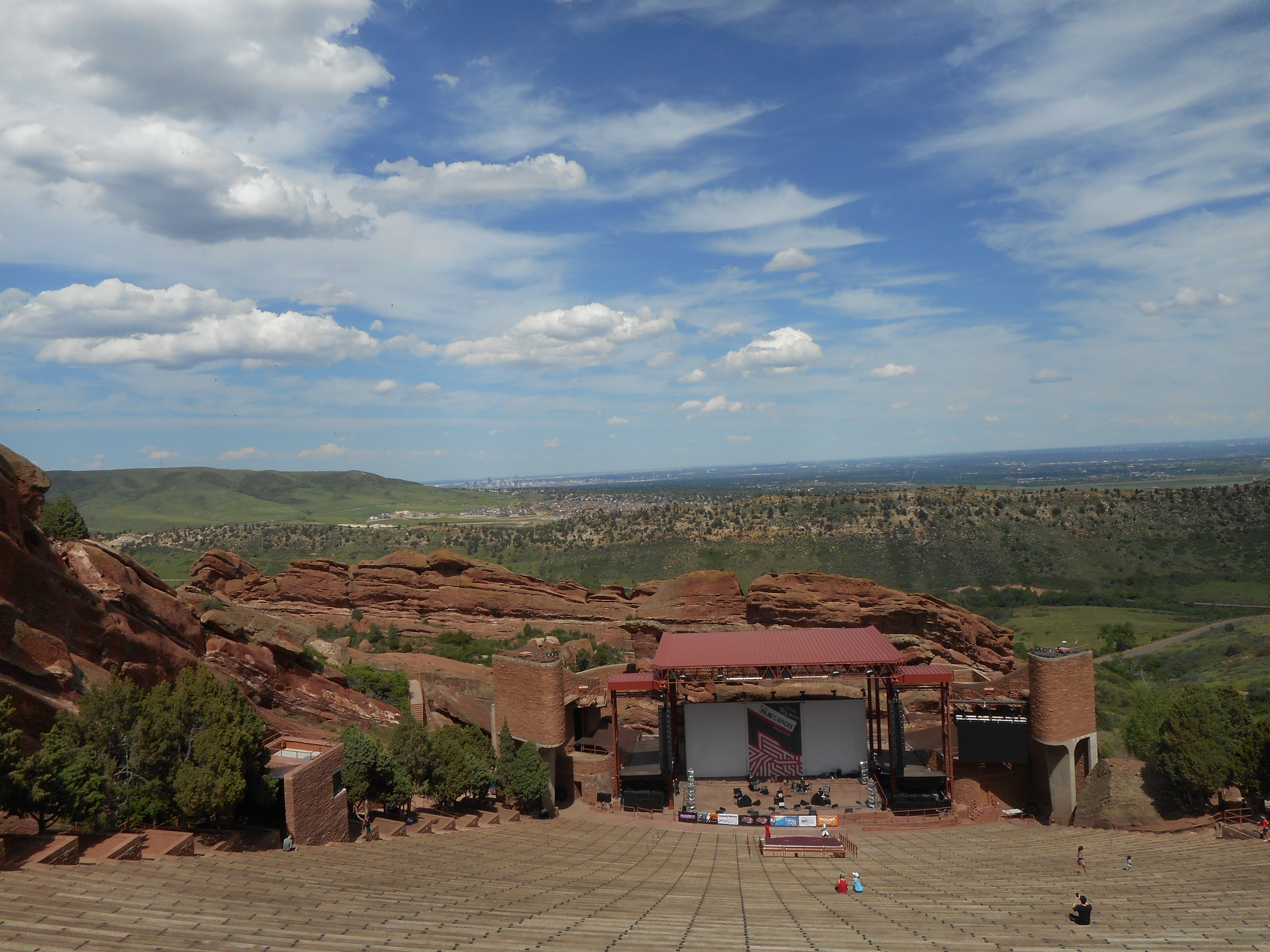
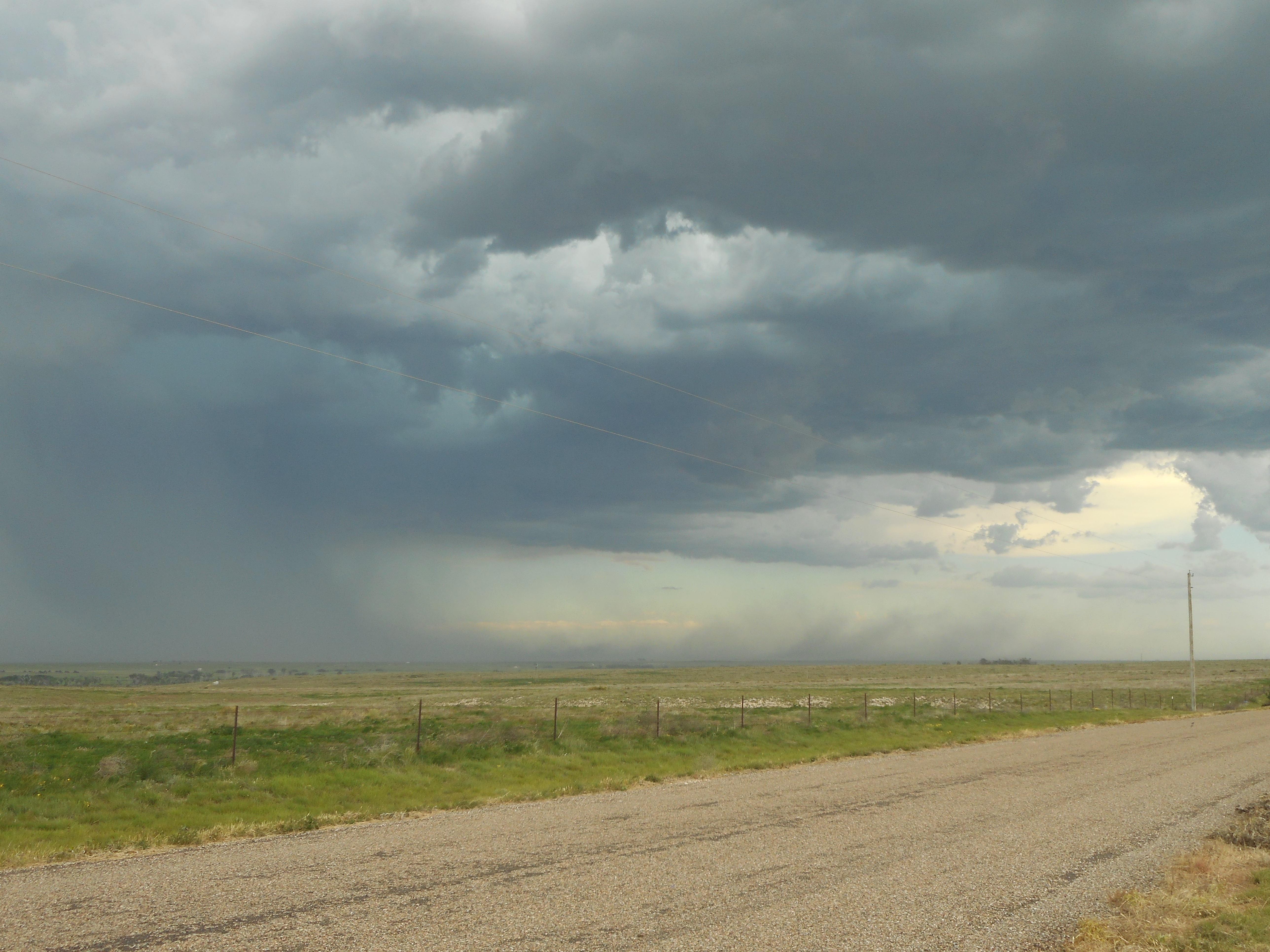
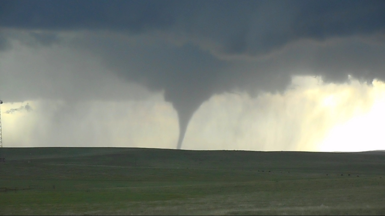
As much as I learned on this trip, it was worth every penny. As Dr. Call told us before we left this morning, he has seen all of us grow as forecasters, teammates, classmates, friends, and adults. Everything that happened on this trip helped me know how to use everything I have learned previously and put it all together, to predict what is going to happen, and be aware of where and when severe weather will occur. I also enjoyed seeing the Central Plains in a whole new light. To visualize the Central Plains puts into perspective just how diverse the United States really are. Also I learned how pictures are simply not enough to grasp the majesty of the weather. You can see a picture of a large supercell, but you don’t think about how large they really are until you are looking at one in real life.

With over 7000 miles traveled in 15 days, I consider myself to be a pretty good storm chaser. With all of this under my belt I feel much more confident in my decision choosing Meteorology as a career. With this newfound confidence, I know I want to help the public’s awareness in severe weather, because the more you guys know, the more lives can be saved from tragic events such as tornadoes, floods, hail, and damaging winds. To do this, I want to either work at the National Weather Service, or at a local television station, possibly in front of the camera, I won’t know that until after broadcast meteorology. I am looking forward to seeing how my career choice changes as my classes become more tuned to certain aspects of the field. I would personally like to thank all of you for following me on this journey. I hope you learned something by doing so. If you see me around and have a question, don’t be shy, ask me, and if I don’t know, I will find out for you. I want all of you to be educated so you know what is going on out there in this beautifully chaotic system.11392861_10205932419522602_5221005321798471079_n

Day 15: Every good thing must come to an end

Day 14: Why we don’t chase in Missouri

Beginning in Grand Island, Nebraska, we decided to chase the south western corner of Iowa. We made our way to Nebraska City, Nebraska for lunch. From there, we decided to chase the south eastern corner of Nebraska. When we made it to Auburn, Nebraska, and storms were firing up literally left and right of us. There was a line to both our east and west. We chased the west line for better storms, but those soon were overpowered by the east line, so we averted to chase the east line, which was crossing the river into Missouri. This causes the issue that there aren’t many bridges across the river, so chasing is difficult. After crossing the river, there were several tornado warnings for different cells. In addition to this, Missouri has a lot of tree lines, and rolling hills, making visibility difficult. All of this caused a very difficult chasing situation. This is why we don’t chase in Missouri. We tried to chase the best looking cell, but were blocked by flooding from a combination of today’s precipitation and yesterday’s. We were forced to turn around and reconsider. We then turned around and headed south to grab another cell but everything began merging together, and an isolated cell formed to our west. We turned around and started heading towards that cell, but when we got there, it had dissipated severely. At this point there was nothing worth chasing so we decided to head south to try to get around it. Of course when we got closer, the line extended farther south, so we were forced to push through the line, which seemed scary at first, but we managed to squeeze through two cells where the rainfall was not as severe. After this we headed towards Kirkville, Missouri to spend the night, and tomorrow drive the rest of the way back to Indiana. Yes, Indiana. The trip is nearly over, there will be one last blog tomorrow to finish things up.DSCN0367

DSCN0368

Day 14: Why we don’t chase in Missouri

Day 13: Gust fronts, a spoon and a roll cloud

Today we began in Fort Morgan, Colorado with our meeting deciding to chase near North Platte, Nebraska. As we approached North Platte, a line of storms began to form directly south of us tracking straight towards us. This line of storms moving north created a strong gust front in front of it. To our north another line of storms moving east also had a weaker gust front in place. On radar it was interesting to watch the two collide, and cause a trigger for some strong cells. A couple hours later, a few more popped up south of the previous cells that looked impressive on radar. When we got there, they were dissipating, and there was a random spoon on the ground so I took a picture. We moved on a little farther east and we observed a roll cloud which is a lowering in the cloud that appears to be rolling and is detached from the base of the main cloud. After this, the storms did not seem worth chasing so we drove to Grand Island, Nebraska to stay for the night. Although the storms were not as organized as we would have liked them, there still was quite a bit to see and learn.

The strong gust front is the semi circle from the south on the base reflectivity on the left, and the bright green pushing against the red on the right window. The weak gust front is the northwest line of the triangle in the center of the left window and shown by the red portion pushing against the green portion in the right window.

6-10-15_453

DSCN0359 DSCN0363 DSCN0366

Day 13: Gust fronts, a spoon and a roll cloud

Day 12: Navigating Denver

Today was a positioning/tourism day, so we first went to Fort Collins, Colorado, to eat lunch, and shop around a little. Then we went up to the Red Rock Amphitheater in Denver, Colorado. I loved it there because it is a natural structure that acts as a natural amphitheater. There was a small museum to go with it which showed all the artists that have performed there. The amphitheater is also at about 6400 ft above sea level, so the oxygen level there is 85% of what it is at sea level. After that we headed into Denver to view the state capitol building. I was the navigator, and I had a incredibly large sheet map to guide us through the city, and some how still avoid the traffic. It was stressful, but I managed. The architecture was pretty incredible. They are making renovations to make some of the meeting rooms look like they did when the building was just built. After that we walked down through downtown Denver, where there was plenty to look at. We took the bus back to our vehicle, and Dr. Call mentioned to me how comfortable I looked on the bus there. I told him that was nothing compared to some of the Ball State buses. After that we ate a Cuban cuisine place, which was actually really good. Finally we drove east to Fort Morgan, Colorado to begin positioning for tomorrow, probably in eastern Nebraska.DSCN0336 DSCN0342 DSCN0353

Day 12: Navigating Denver

Day 11: “Chase Fail”

Starting in Guymon, Oklahoma we had our morning meeting and decided to head to Tucumcari, New Mexico, because it had the highest potential for storms. Although the wind shear was still not there, and the convective potential was not the greatest, it still was better than any reachable chase area. We travelled through the corner of the panhandle of Texas to get to Tucumcari. We were going to tour some museums today, but they are only open Tuesday through Saturday. When we began to chase storms, there was a large single cell, with supercellular properties, such as a hail core, and a rain free base in northeast New Mexico. We intercepted it the best we could with the road network. We watched the first cell pass over the mountains, then headed more north to a multicell which by the time we made it to it had clumped together into a couple of cells producing something similar to a shelf cloud, just a little less organized. We followed this a little while longer, then when we decided to leave, there was a small green cell on radar just northeast of the cell we were chasing. When we made it to the cell we were getting pelted with pea-sized hail. The radar updated a few moments after, and showed a hail core. After Dr. Call saw this, he said, “Chase fail” So today we learned the radar is delayed, so spotting in real time is just as important as watching radar. To end the day we drove north through Raton’s pass with an elevation of 7900 feet above sea level, to Trinidad, Colorado.DSCN0329 DSCN0331 DSCN0333

Day 11: “Chase Fail”

Day 10: Oklahoma Line

Today was a different kind of chase day because were chasing quasi-linear convective systems, commonly known as squall lines. So tornadoes were not what we were after today. These kind of storms hit Indiana a lot more, so these storms are more relevant to you guys at home that were affected by similar storm structure today. The main focus today, was the structure of such systems and observing them in real time. Cool things we observed today were shelf clouds, and gust fronts, which are caused by the storms downdraft, and often help maintain the strength of the line by creating an updraft for a new cell. We also observed areas where we could see the hail core of storm cell, as seen in the second image in the turquoise section to the left of the image. I learned a lot about structure I had never seen so close. We were so close, I got a picture from behind the shelf cloud as seen in the fourth image. We started in Colby, Kansas and ended up in Guymon, Oklahoma.

DSCN0297DSCN0286  DSCN0295 DSCN0302

Day 10: Oklahoma Line

Day 9: The Normal Day

Things slowed down today, but were still awesome. Dr. Call mentioned to us how lucky we were, because on some trips, what we saw today was the best if not better than what we saw. We started out waiting in Colby for storms to start firing up. Eventually what appeared to be a multicellular line turned into an isolated supercell with rotation and decent structure. This cell received a tornado warning, but didn’t spawn a tornado that we saw. There was a tornado reported, but we think it was either before we arrived, or what they saw was some cloud lowering, that was not rotating. (seen below) The cloud lowering we observed was actually a result of the inflow into the mesocyclone of the supercell. At tornado was also unlikely from the cell yesterday, because the cloud base was too high at about 4000 ft. Also the low level shear was not as strong as it needed to be as mentioned on Day 7 It is important to be able to classify these structures correctly, because this could cause some confusion if a cloud structure is misclassified as a tornado. So today we learned how lucky we are, and the importance of correct classification.

DSCN0247DSCN0253DSCN0260

Day 9: The Normal Day

Day 8: Danger Zone!

Another amazing day guys! I was chase leader again today. Starting in Colorado Springs, Colorado, we decided to chase Northeast Colorado. Since we didn’t have far to go, we toured Garden of the Gods in Colorado Springs. There were some great elevated sedimentary rock structures. While we were touring, storms started to fire up northeast of our location, so we decided to get lunch quick and get on the road. When we started to intercept the original storm we wanted to chase passing over Genoa, Colorado another cell formed south of it and cut off its inflow, lessening the effects of the storm. This storm was also inhibited by other nearby storms so we decided to pursue a storm farther east passing over Siebert. This storm produced a wide tornado, which we all got a great view of. We continued to chase this cell, which led us into a bit of a predicament. A cell forming on our escape route was cutting off our route because we were using the local dirt/gravel road network to keep up with the cell, but with the cell raining on all of our escape routes, the roads were slippery. We decided to try to escape, but while trying we got stuck on the side of the road in the mud. Eventually some storm chasers with a nice truck with a winch pulled us out of the mess and then towed us roughly 4 miles down the road until we could drive semi safely down the road to the nearest paved road. By semi-safely, I mean we were still swerving on the slick roads. We are camping in Colby, Kansas tonight, which is our first time being in Kansas on the trip. So today, I learned that not only is it difficult to find a tornado, but also difficult to manage an escape path.

DSCN0226  DSCN0229 Snapshot(2)DSCN0235

Day 8: Danger Zone!

Day 7: Look! A tornado! There’s another one! And another!

Most exciting day ever guys! We started with a morning meeting as usual, decided to wait for storms to form, so while we waited we visited NCAR (National Center for Atmospheric Research) headquarters in Boulder, Colorado. We toured there for a while especially interested in the tornado exhibit. The view in Boulder of the Rockies was amazing. Especially from NCAR overlooking the city. While we were getting lunch in Boulder, We noticed some storms firing up to our east, so we pursued. As we got closer to the cell, the cell became more defined. We chased the cell near Simla, Colorado. When the funnel started to drop, I had a euphoric feeling come over me. This was my first tornado experience, so I was somewhat scared, but adrenaline took over my body. I remember shaking because the wind was so strong, and we were still about 5 miles from it. We followed the cell as it tracked northeast, all working together to make sure we were safe, we had an escape route, and still keep track of all the tornadoes. We got some great photos, because the cell was so photogenic, because the grass was so green and the contrast between the sky and the tornadoes were so great. Although there were a couple rain-wrapped tornadoes that were difficult to see. We also observed a couple gustnadoes, which are caused by low level wind shear, or change in wind direction or speed with height. So the wind created a small eddy which was intensified by the storm. It was also interesting to notice the sheer power and structure of the storm. It was easy to notice the inflow and outflow of the storm as we could see the storm pulling in warm air and lower clouds from in front of the storm. So today, we learned how important good communication and also how everybody has an important job as well as how important structure is to tornado development.

DSCN0222 DSCN0213 DSCN0216Snapshot(11)

Day 7: Look! A tornado! There’s another one! And another!

Day 6: Desperate Attempts for Anything

Today began with a very quick morning meeting so we could get on the road quickly and into place for what seemed to be a very promising day. Dr. Call walked in asked where the target city was, agreed and then said “Let’s move” All the indices we need to form tornadic supercells were pointing to our area. The Storm Prediction Center even issued a tornado watch for the area.  Our target city was originally Cheyenne, Wisconsin, but we ended up in the small town of Lingle, Wisconsin waiting for the storms to form. Nothing impressive turned up for a while, so we played, soccer, football, and ultimate frisbee, at the local park. For the storms we were expecting to form we were missing one thing. The trigger. We needed a boundary such as a front to push the clouds past the stable layer of the atmosphere preventing any strong storms from forming until later that night. We call this stable portion of the atmosphere the Cap, or CIN (convective inhibition). After about 4 hours of waiting for a storm to form, a cell twenty miles north of us, was honored the famous thunderstorm warning watch-box. We deployed to see a decent mesocyclone. After following this for a while it got dark, and we couldn’t see anything, so we started heading to our hotel for the night. We found out later, that after it was dark the storm went supercellular with lots of rotation. Kinda disappointing. This is the things we learn from. Today I learned that even if one thing is missing, storms may not fire up. Just because the models and indices say there will be storms doesn’t mean there will be storms.

DSCN0190DSCN0186

Day 6: Desperate Attempts for Anything